Cleveland Hills – Frontier of the Yorkshire Moors
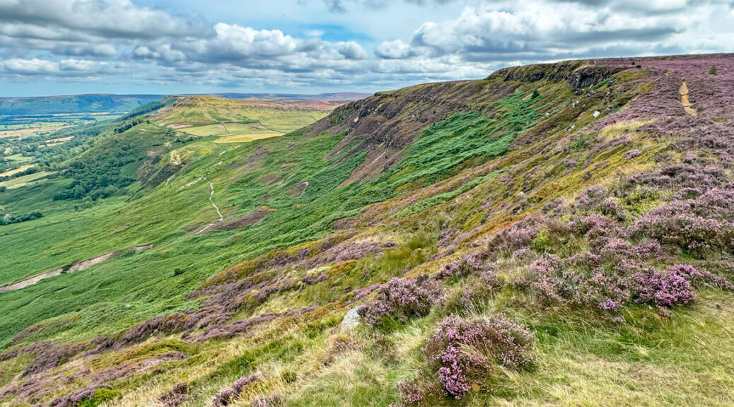
The subject of this Yorkshire Worthy is a noble curving escarpment, dramatically delineating the north western termination of the North York Moors. The extent of the full escarpment is around fifteen miles, although it is the western half that is the most distinctively enjoyable, comprising an undulation of four linked hills – Carlton Moor, Cringle Moor, Cold Moor and Hasty Bank.
These hills afford a sense of immediate prominence and perhaps for this reason have been aptly named the Cleveland Frontline, although as yet I have found no substantiation of this little-known title, except that it more popularly refers to a brand of golf putter! Another promising local name is the Four Sisters, again without definitive provenance, although supported by a number of Cleveland Hill natives and that’s good enough for me. So, an informal four sisters it is.
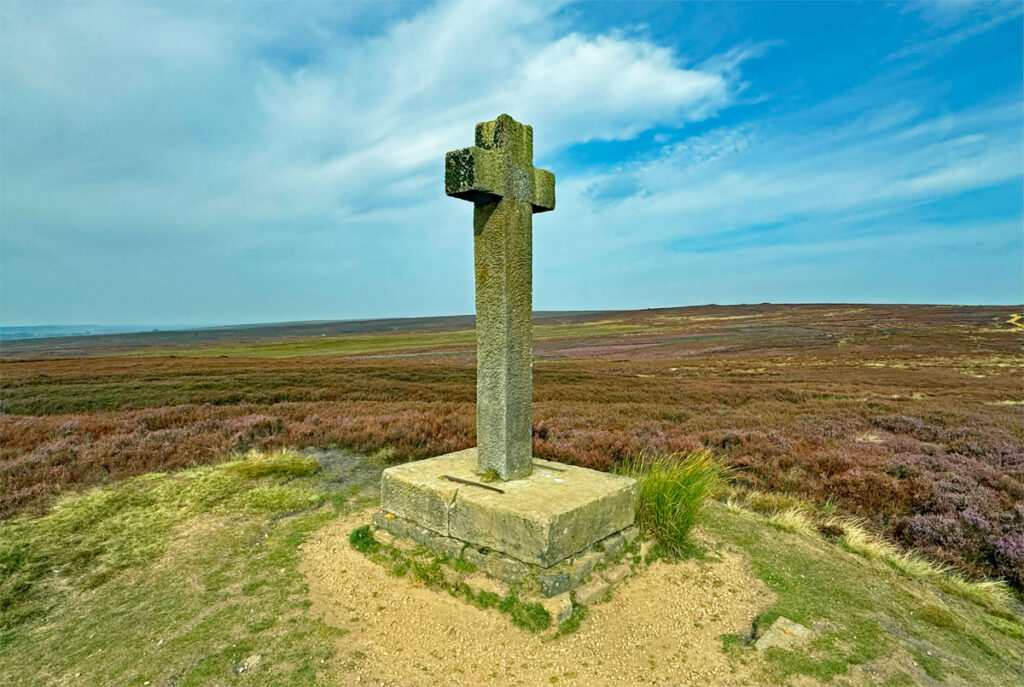
Regarding prominence, Roseberry Topping is the most eye-catching peak in the Cleveland Hills, a diminutive Matterhorn rising at the north western tip of the range, effectively an outlier, its degree of isolation assuring extensive views, although being detached and with less than 750ft of ascent, the overall experience of climbing it is sweet but short and insufficient to warrant Worthy status. Individually, our chosen four tops are also short and sweet, however, it is their convenient combination that clinches the deal. None of this bothers Roseberry Topping of course, which, due to its pleasing profile is by far the most climbed of the Cleveland Hills and the local darling of social media.
As for Cleveland, this was an ancient district of Yorkshire, although for a period of twenty-two years from 1974 it was a name also given to a county, which did not actually include the Cleveland Hills. Even the boundaries of the Cleveland Hills are debatable, although all agree that they do include Urra Moor, the highest point of the North York Moors National Park.
The map can be moved and zoomed in or out to change the scale
The ‘Frontier’ runs east from Live Moor above Swainby, then turns north at Urra Moor before terminating at Kildale Moor, above Kildale village. If you are able to walk the route as a linear excursion, then including Urra Moor (or further) is a worthwhile addition, otherwise a circular walk of the four sisters can be performed by utilising either the laybys or car parks at Clay Bank and Lordstones Country Park. An outwalk walk over the summits is then followed by a return on lower paths traversing the northern slopes. A good source for a recommended route is: https://www.paulbeal.com/cleveland-4-peaks/
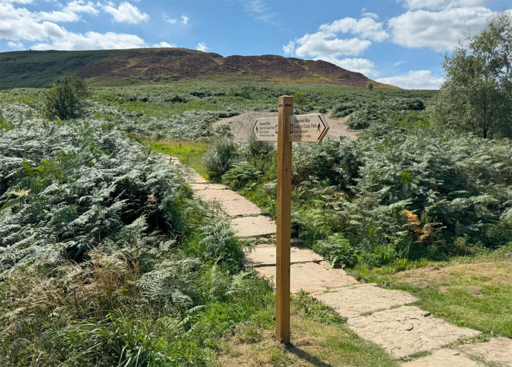
Basically, the paths over the hills follow a section of the Cleveland Way, the second oldest official National Trail in Britain, waymarked by acorns, and in England administered by Natural England, a government agency. This brings in both public and business funding to help maintain the paths. As regards the Cleveland Way, our section of hills has seen mammoth attention, the path frequently flagged and pitched with local stone, despite the relative quietness of the area. I recently walked these hills on an August Sunday afternoon and saw just a dozen people. There are also many new signposts, as the four hills are shared with Wainwright’s Coast to Coast Path, which is undergoing transformation into a National Trail, with its official opening in spring 2026.
Furthermore, our route is also shared by another well-known trail, the Lyke Wake Walk. This forty-two-mile moorland epic challenge, intended to be completed within twenty-four hours, predates both the Pennine Way (the first National Trail) and the Cleveland Way, although they took decades to devise and secure access. Nonetheless, what is interesting about the Lyke Wake is that there is no ‘official’ route, merely a suggested one, but whichever way you go, you have to get from the start to the finish!

Let us now commence our circular walk of the four sisters from Clay Bank, where parking is available for free in laybys or paid in a Forestry Commission car park. The paved path heads directly up Hasty Bank and, as you make the early part of the ascent, note the evidence of quarrying, this former industrial activity in various forms will become a frequent sight during the walk. More on that later. Also, for those in search of something unusual, there is an obscure sight in a sandstone quarry on south side of Hasty Bank – a bizarre carved face called the Lady of Bilsdale, reached by a narrow track heading off left at beginning of the walk. For more information see here: https://walkswithtsb.blogspot.com/2020/05/hasty-bank-cold-moor-and-upper-bilsdale.html
Heading up the main path, the view soon opens out to the east across to the plateau of Urra Moor. Our climb is around 430ft (133m) and typical of the four ascents of the walk, which cumulatively will involve around 2,000ft of climbing and 9 -10 miles. Hasty Bank is marginally the lowest of the four peaks, although that has no significance to the splendid outlook. The actual summit has no particular features, not even a cairn, being a generally level ridge of heather and bilberry bushes, the slopes plunging down steeply to the north, which again sets the scene for what is to come, as the eye is drawn along the escarpment.
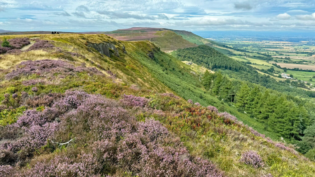
Like so many local place names the origin of Hasty is Norse, derived from ‘horse’ and it’s not difficult to imagine the summit being adopted for equestrian exercise. Interestingly, Hasty Bank was the hill that most appealed to Wainwright when laying out this part of his Coast to Coast walk, describing it as “the most impressive of the Cleveland Hills… its fine summit deserves a distinctive name of its own”. Some do call it by the name of the Hasty Bank’s north eastern promontory, White Hill.
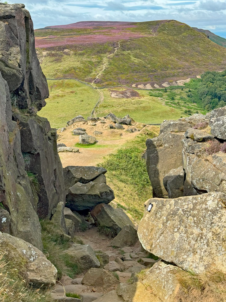
Perhaps the reason AW was so charmed by Hasty Bank is due to the presence of a “cluster of fanged and pinnacled rocks; the Wainstones”, which distinguish the western end of the hill. These sculpted sandstone crags are the most favoured haunt of rock climbers on the moors, with over one hundred named climbs on both the main crags and the adjacent boulders. Whilst the first recorded routes here date from 1906, these crags attracted much more ancient visitors, evidenced by prehistoric rock art, the carvings created in Neolithic times. Sadly, there is much modern graffiti too, although to find the best of the albeit elusive ancient ‘art’, examine the more shy, surrounding boulders that have mostly escaped the chisel of the latter day Neanderthals!
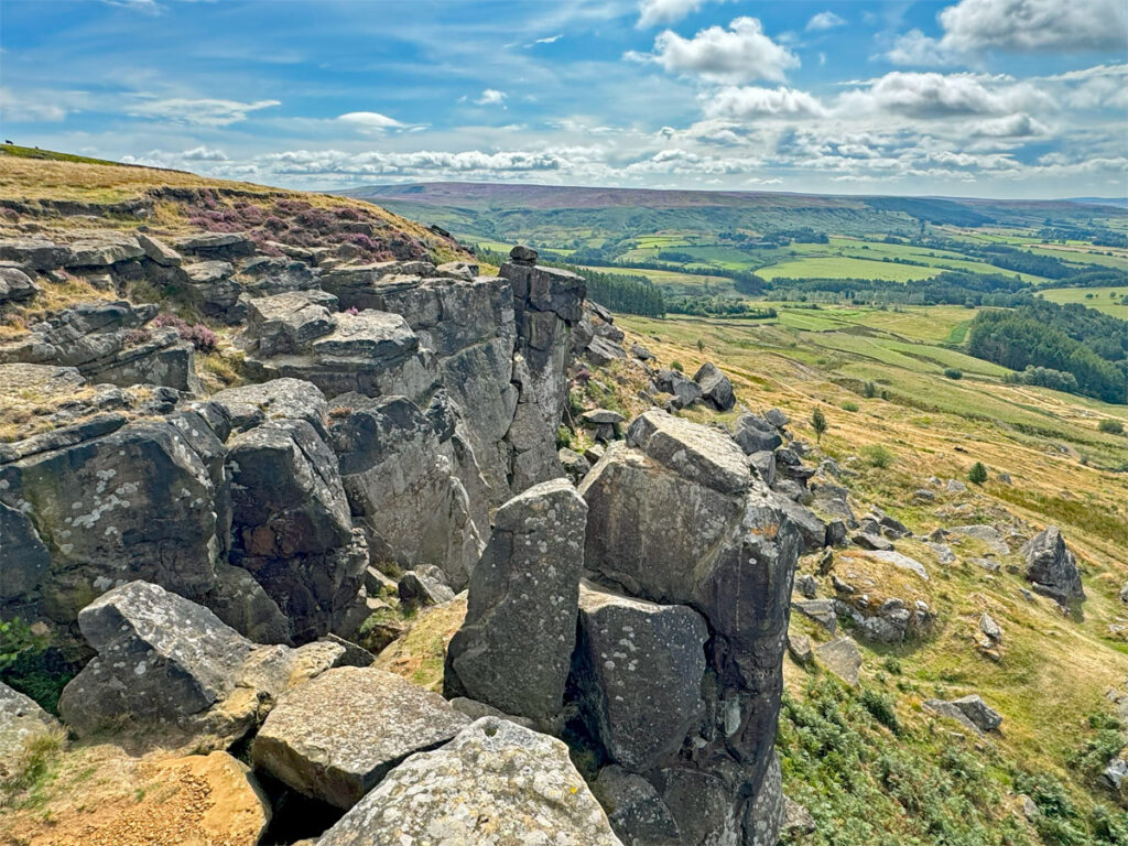
Industry
The descent of around one hundred metres arrives at the walled fields of Garfit Gap, with Cold Moor rising to a similar height ahead. Take a look around you and study the lay of the land, much disturbed by the pick and shovel of a previous age. There are spoil heaps of shale dotted around and uneven mounds, created by the (often collapsed) adits of Jet mines. The Cleveland Hills suffered quarrying for Alum, followed by mining for Jet, the jewellery that made Whitby famous. Alum was a filthy business and involved slowly burning vast extractions of shale for many months to produce small quantities of Alum, that were principally used as a mordant, to fix colours in dyed textiles. These hills were the principal concentration of Alum production in Britain during the seventeenth and eighteenth centuries.
Jet is wood that became fossilised in mud, so it occurs randomly and not in seams. However, being in sedimentary layers, once discovered it can be prospected for in surrounding areas at the same altitude. In the Cleveland Hills this is around the 900ft contour. The mines throughout these hills attained the peak of production in the latter half of the nineteenth century, following the accidental popularisation of wearing Jet by Queen Victoria in 1861, who chose this sombre jewellery as a symbol of her mourning for Prince Albert.
The neighbouring hills of the North York Moors also played their part in the Industrial Revolution, producing Ironstone that was railroaded to the smelters of Middlesborough.
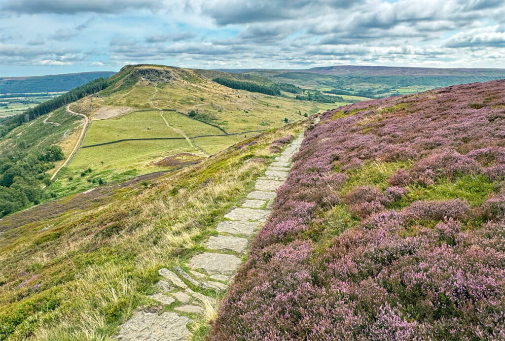
Cold Moor (pronounced by the locals as ‘Cawdma’) as we experience it on this walk may be merely a gentle dome carpeted in heather and bilberry, but a couple of centuries ago the summit area bore the grandest name of all the Cleveland Hills – Mount Vittoria Plantation. The 1857 OS map prints it as such, and it was indeed planted with trees, although by the 1890 survey both the trees and the name had disappeared. Certainly the exposed top was a less suitable place for growth than the long standing forests that occupy the lee slopes to the north. Walking across the top, the views subtly change, although there has been one constant to the south since the outset of the walk, namely the Bilsdale Moor TV Transmitter, ensuring the signals reach from around Leeds to Durham. The mast is 1004ft tall, slightly shorter than the previous mast, which was damaged by fire and replaced in 2023.
Similar to the previous gap, the green of walled fields greets our descent, perhaps causing you to recheck the map to determine your location as the hill ahead looks similar too, like something of a Déjà vu. Nonetheless, ahead is Cringle Moor, the highest of the four sisters and the second highest point on the North York Moors at 1417ft (432m) and it’s a place packed with interest.
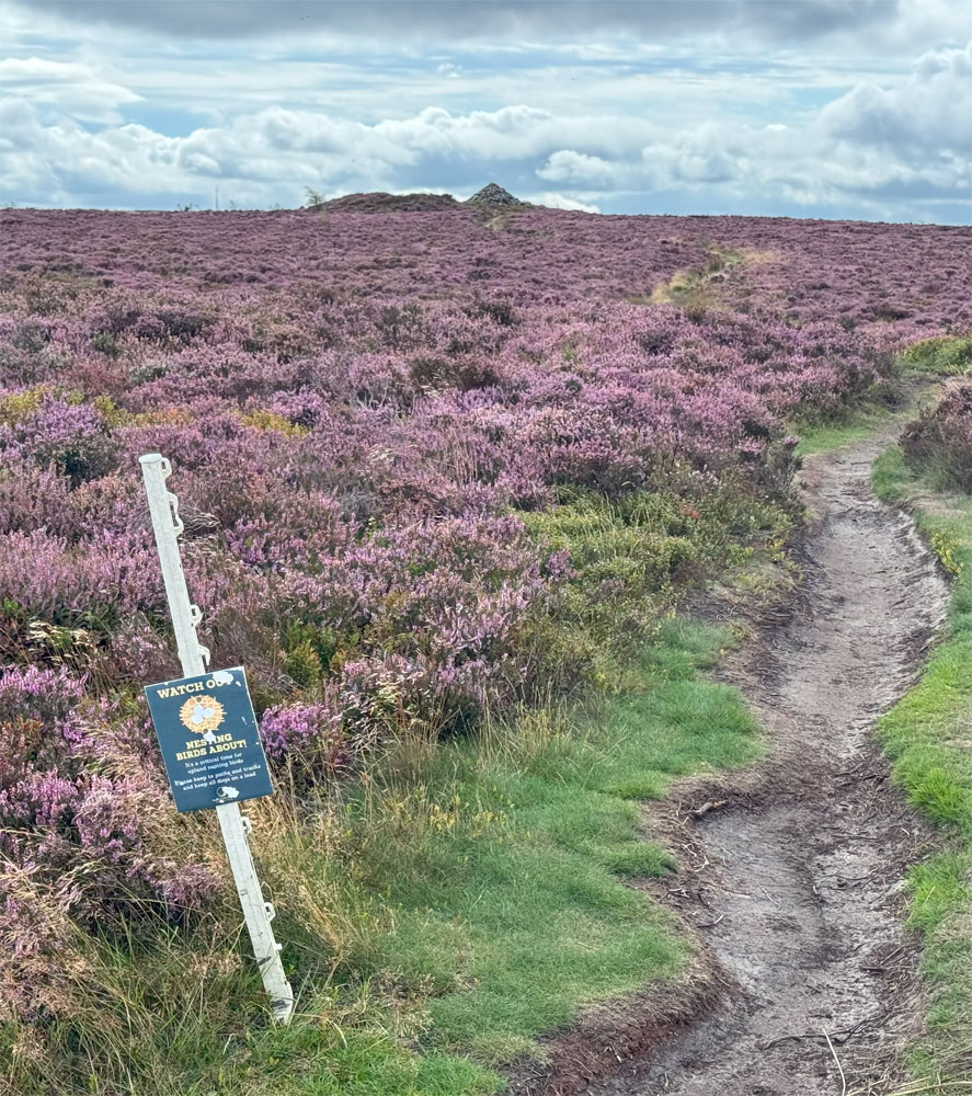
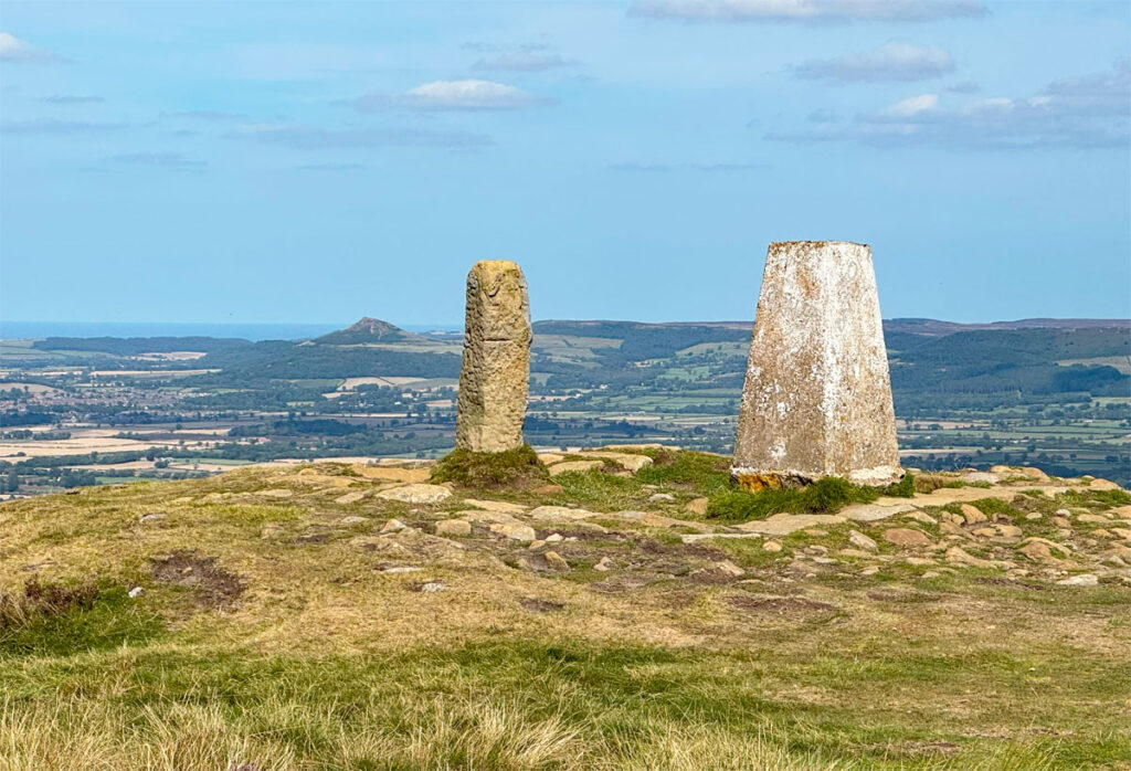
By now you are becoming accustomed to the short, sharp ascents and Cringle Moor is atypical. However, the walk across the top is particularly fine, with the sinister north facing escarpment, Kirby Bank, being closely traced at its edge. Peer over and you will see uneven ground way below that again marks the remnants of the Jet mines. The main path along the edge misses the moor’s highest point completely and a short diversion is required. The summit cairn is obvious and stands at one end of a large, vegetated mound called Drake Howe. The clue is in the name, as Howe is another Norse word and refers to an ancient barrow, a Bronze Age tumulus (or cairn, confusingly) used as a show of status and as a burial place. Beside the summit cairn is a boundary stone, one of many seen on this walk, inscribed with a letter E on one side and F on the other, marking the boundaries of the respective Emerson and Feversham land estates.
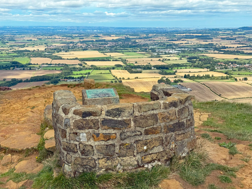
Returning to the edge, the path curves round to Cringle End, a splendid viewpoint capitalised on by a stone seat and toposcope erected in memory of Alec Falconer, a founder member of the Middlesbrough Rambling Club and a major protagonist for the Cleveland Way.
Our descent enters what has become the Lordstones Country Park, with a café, campsite and modern stone circle dating from 2013, seen to the right on an open field called Green Bank. Lordstones is drawn from another boundary stone, once again adjacent to a barrow (there are three within the grounds). This stone is called the Three Lords’ Stone and marks the boundary of three Lordly manors and is situated on the left just before where the Cleveland Way crosses the road to embark on Carlton Moor.
After another 100m or so ascent, arrival on to the summit reveals an extensive plateau, where once walkers needed to take care as they followed the perimeter of a glider club runway. The final flight took place around 2008, the buildings subsequently demolished with national park funding, and the land is being reclaimed by nature.
Carlton Moor extends west for a considerable distance and for those taking a linear walk of the four sisters, your route will continue over Live Moor, itself abounding with barrows, an Iron Age hillfort and several boundary stones.
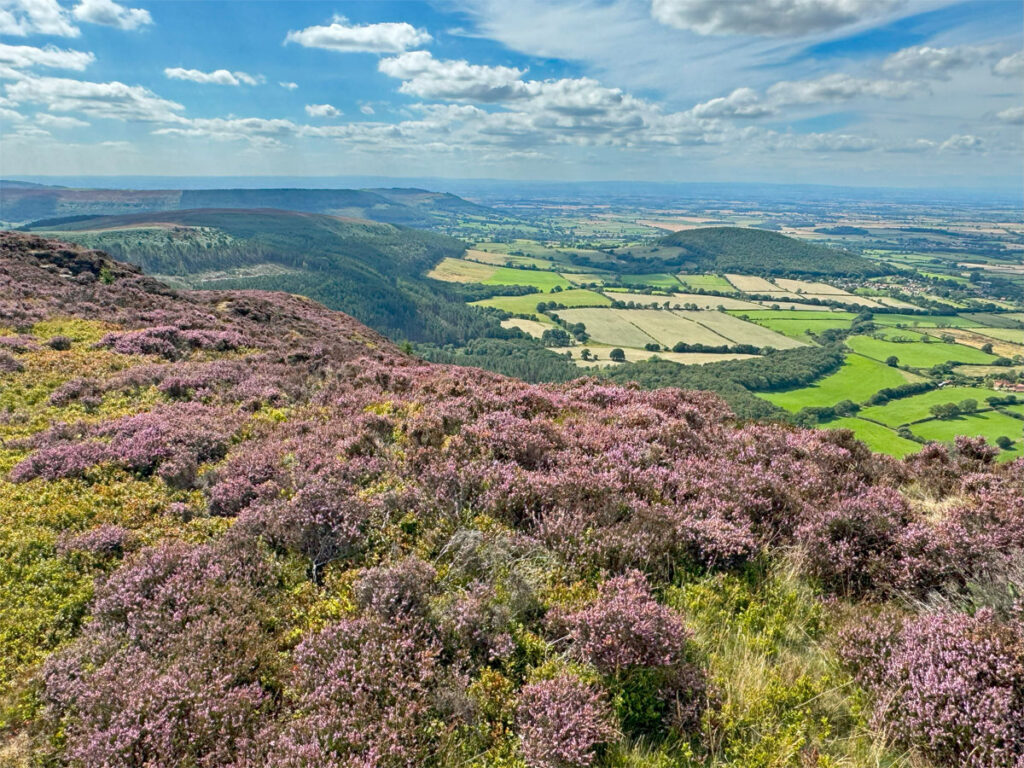
For those on a circular outing, you will have already guessed how this will be achieved. Obviously a return over the four sisters is perfectly possible, although there is the option of a lower path, seen very clearly during the outward walk. The route is known as the Miners’ Trod and generally traverses along the 300m contour. This is usually around the level of the former Jet mines and, for the curious, examining the clues of former industrial activity is fascinating.
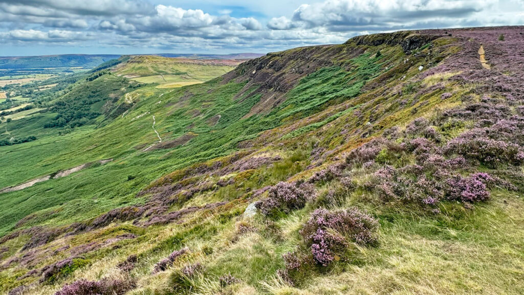
From the summit, a look at the map suggests the finest natural route would be to continue along the path as it drops south west off Carlton Moor to the tree level at Faceby Bank. Then turn around and join the trod heading back east. Unfortunately, I would not recommend this during the summer when the trod at this point becomes extremely overgrown. Instead, descend northwards, steeply at first directly from the summit and down to the sprawling remains of Carlton Bank Alum Quarry. This was one of Britain’s first Alum quarries and in use until the 1770s. Two hundred and fifty years later, it’s still an eyesore as grass struggles to grow on the shale.
From the quarry, the Miner’s Trod is straightforward for the whole way back to Clay Bank, taking an enjoyable stroll beneath the tops of the remaining three hills. And you may be pleased to know that return route will take less than half the time of the outward leg!
Worthy Rating: 72.5
Aesthetic – 22.5
Complexity – 12
Views – 16
Route Satisfaction – 15
Special Qualities – 7