Ingleborough – Paragon of the Yorkshire Dales
Ingleborough was the nearest ‘proper’ mountain to my childhood home and the first over 2,000 feet that I ever climbed. I was twelve years of age and took the bus to Ingleton one very wet winter Sunday. I didn’t see a thing all day and my primitive waterproofs were wholly inadequate, yet the sodden experience did not put me off, and repeating that ascent became a regular feature of my teenage years.
Now fifty years later, it was a hill that in my mind automatically deserved a place on the list of Worthies, however, is youthful exuberance alone sufficient to claim that distinction? Let’s take a look at Ingleborough in detail and find out…
The map can be zoomed in or out to change the scale
Background
Ingleborough is not the highest mountain in Yorkshire but it is the most complex and its footprint is bountiful with geological interest. Along with Ingleborough’s two neighbours, Whernside and Pen-y-Ghent, this mountain triumvirate of the Yorkshire Dales National Park comprises the celebrated ‘Three Peaks’, whose circuit provides one of the most popular walking challenges in Britain. However, for an individual climb it is Ingleborough that claims the majority, partly through offering more routes of ascent but especially through exhibiting more places of particular interest.
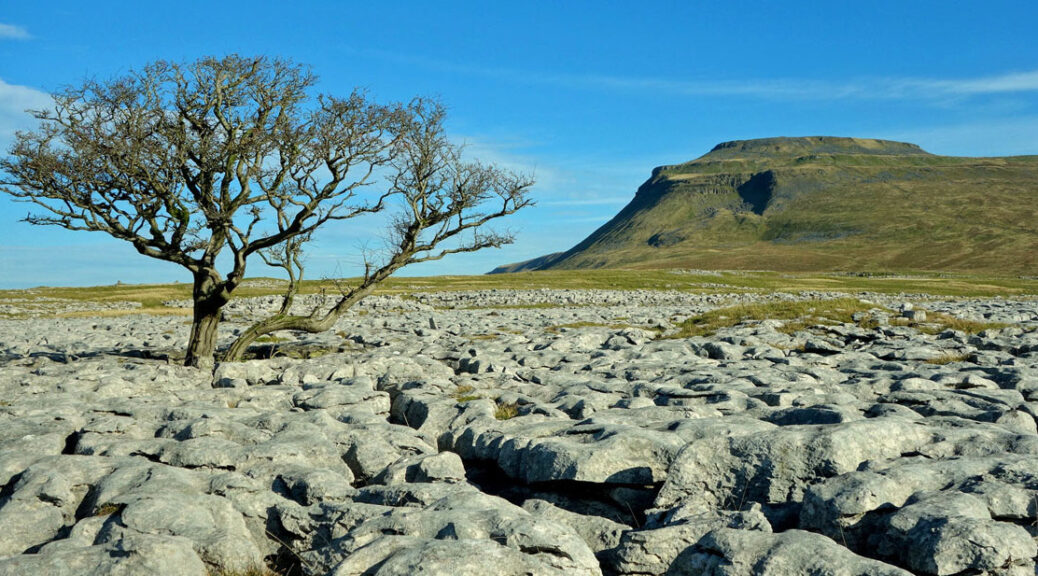
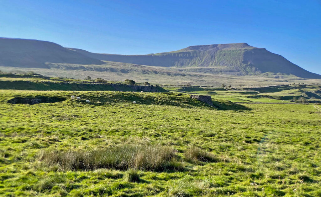
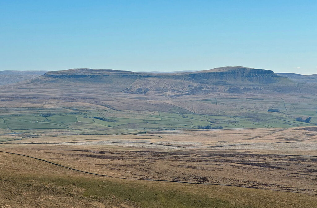
From afar, Ingleborough is a compelling presence, like a mammoth terraced pyramid decapitated below the apex. The same geological processes were common to the three peaks, although Ingleborough manifests the outcome more comprehensively, as though created to be the definitive textbook on the subject. It is natural that such consequential geology should be protected, resulting in a number of National Nature Reserves (NNR) on the mountain.
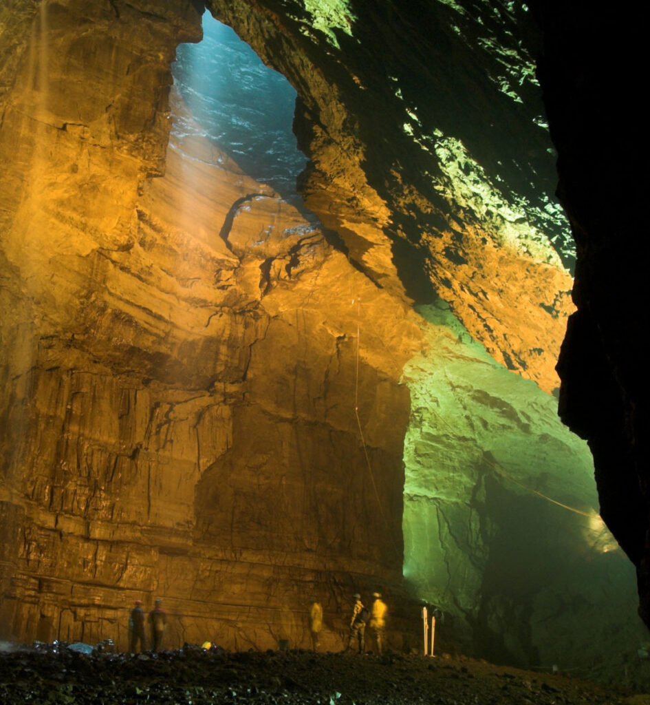
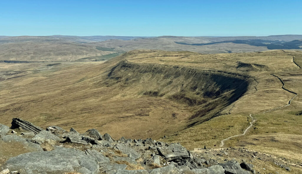
Ingleborough is a shining example of a Karst landscape (the name derives from the Kras region of Slovenia), showcasing distinctive limestone topography formed through the chemical dissolution of its calcium carbonate rock structure. This produces caves, underground rivers, dry valleys, sinkholes, pot holes, limestone pavements and crags, with Ingleborough displaying all of these in abundance. The cave systems of the mountain are legendary, boasting two illustrious public show caves and Britain’s tallest underground waterfall plunging into Gaping Gill. Ingleborough is a vast Swiss cheese, the principal potholes having formed at the junction of permeable/impermeable strata on approximately the 400m contour running in an arc around the mountain.
The region was also subject to repeated glacial events that shaped the landscape, although they did not produce corries typical of the higher mountainous regions, however, valleys were deepened and much debris left behind when the glaciers melted.
There is no definitive derivation of the name Ingleborough. Ingle likely refers to it being a hill or a beacon and Borough may well derive from a fortified place, most obviously the vast, flat summit that was at some point occupied.
Routes of Ascent
Ingleborough stands at 2373ft (723m) and can be climbed from almost any angle, although there are four main focal centres, each offering a variety of paths, altogether offering far more diversity than the neighbouring peaks of Whernside (2419ft, 737m) and Pen-y-Ghent (2273ft, 694m).
The ascent widely accepted to be the finest is that from Clapham, which visits many of the mountain’s most famous features. Wainwright was particularly unrestrained with his praise, even suggesting that the standard route is to be recommended in both directions rather than take any diversions. I agree that it is a fine walk, although controversially, I believe a round trip does improve the experience and also that a circular route from Chapel-le-Dale is its equal.
Clapham is a delightful village, developed by the Farrer family who bought the estate two hundred years ago primarily to exploit grouse shooting potential. Up until the Second World War the southern flanks of the mountain were awash with heather, although most of this land was repurposed due to the need to feed the nation and subsequently grouse shooting never recovered. Fortunately, in more recent years reduced stocking levels are beginning to encourage the reappearance of heather in some areas, although sporting interests are unlikely to be re-established.
The home built by the Farrer’s was Ingleborough Hall, with luxuriant gardens created by Reginald Farrer, a renowned Victorian botanist who introduced many alpine plants into Britain. The nature trail from the village to begin the ascent bears his name. Unfortunately, the burden of wartime death duties forced the family to reduce the size of the estate and the hall was sold, later becoming an outdoor education centre for Bradford Council, hosting around eighty schools a year. In the present day, the council are currently enduring financial pressures and seeking to sell the building.
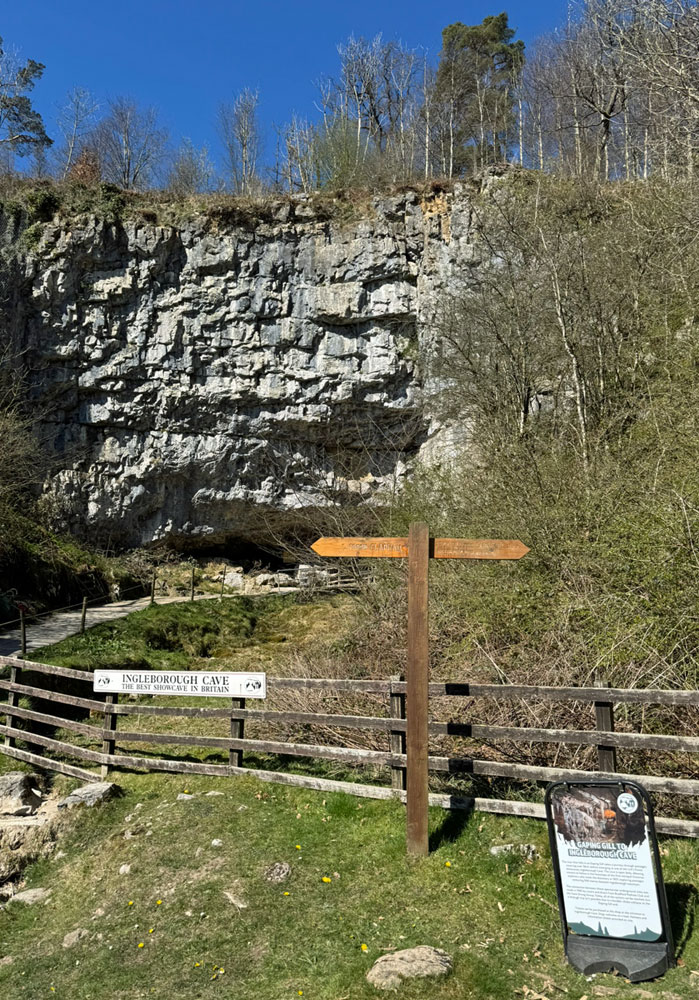
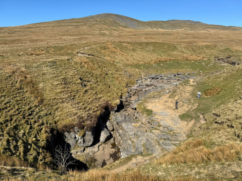
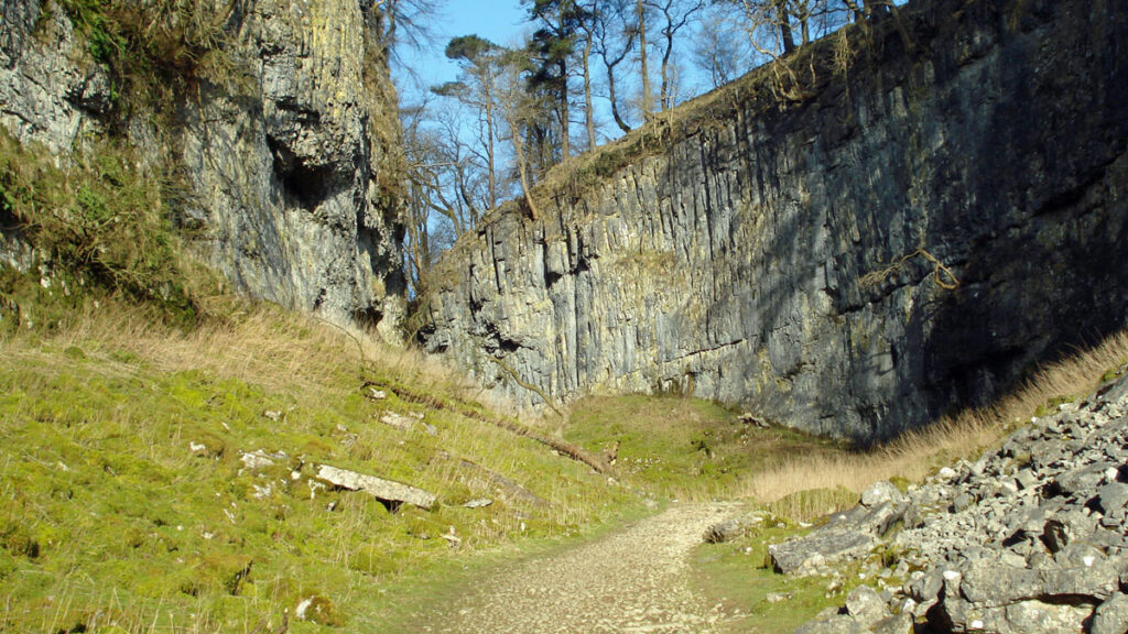
The Reginald Farrer ornamental nature trail is a paid attraction (but can be avoided) and leads to Ingleborough Show Cave, both remaining in Farrer family possession. Beyond here is the next wonder of the mountain, Trow Gill, a dry valley between imposing crags, originally cut by torrents of glacial meltwater. The character of the route changes from here as open country is attained and the looming bulk of Ingleborough rises above. However, before that is tackled, yet another world-famous attraction can be visited. This is Gaping Gill, a 100m shaft plunging vertically into an immense chamber. Twice a year local pothole clubs arrange winching sessions for the apprehensive public to descend into the public face of a 15km cave system.
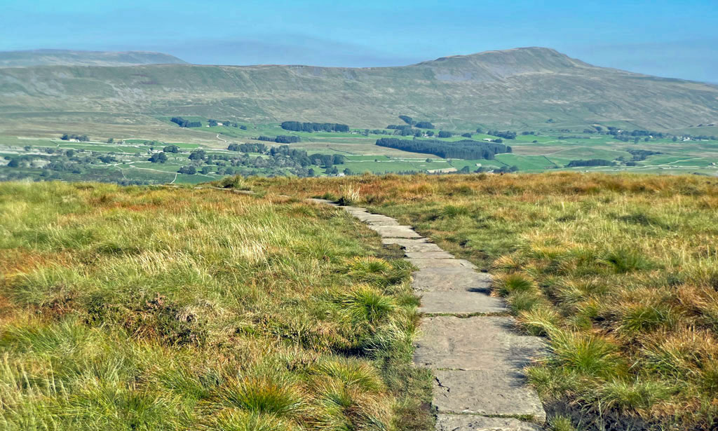
After an enclosed lowland approach, the climb to Ingleborough summit now becomes a mountain walk for the final third of the route, heading steeply up to the subsidiary top of Little Ingleborough and then more gently onto the summit plateau. When climbing Ingleborough from Clapham, I prefer to descend this way but make the ascent by approaching via Norber, which extends the walk into far more of an overall mountain experience.
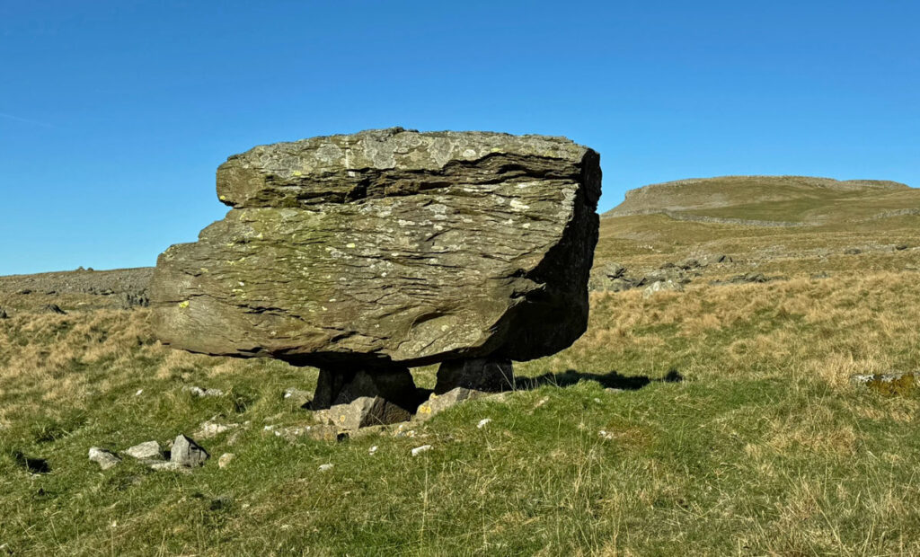
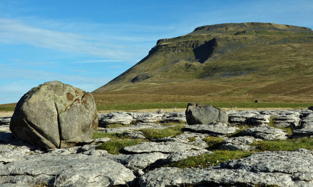
The Norber Erratics are a remarkable, otherwordly sight, a sweeping field of jumbled rock, the most striking boulders being perched on pedestals of limestone, where the surrounding rock has been worn away by weathering. There are thousands of stones, large and small, that were collected and transported by a glacier flowing through Crummackdale, then deposited when the ice melted. Whilst the ground on which they stand is composed of Carboniferous Limestone, the erratics rocks are older Silurian Sandstones. The term erratic merely refers to the boulders not being in their place of origin.
After crossing the wall above the stones, one can climb to the top of Norber Scar and follow the broad ridge beyond or keep right along the upper slopes of Crummackdale, both routes eventually encountering the far more substantial path ascending from Horton-in-Ribblesdale. This path has been much ‘improved’ due to being part of the Three Peaks circuit. The upper part leads in a surprisingly gentle fashion across the southern flanks of Simon Fell to join its connecting ridge to Ingleborough, at which point the predominantly moorland views suddenly expand, with Whernside, the Howgills and Lakeland bursting onto the scene.
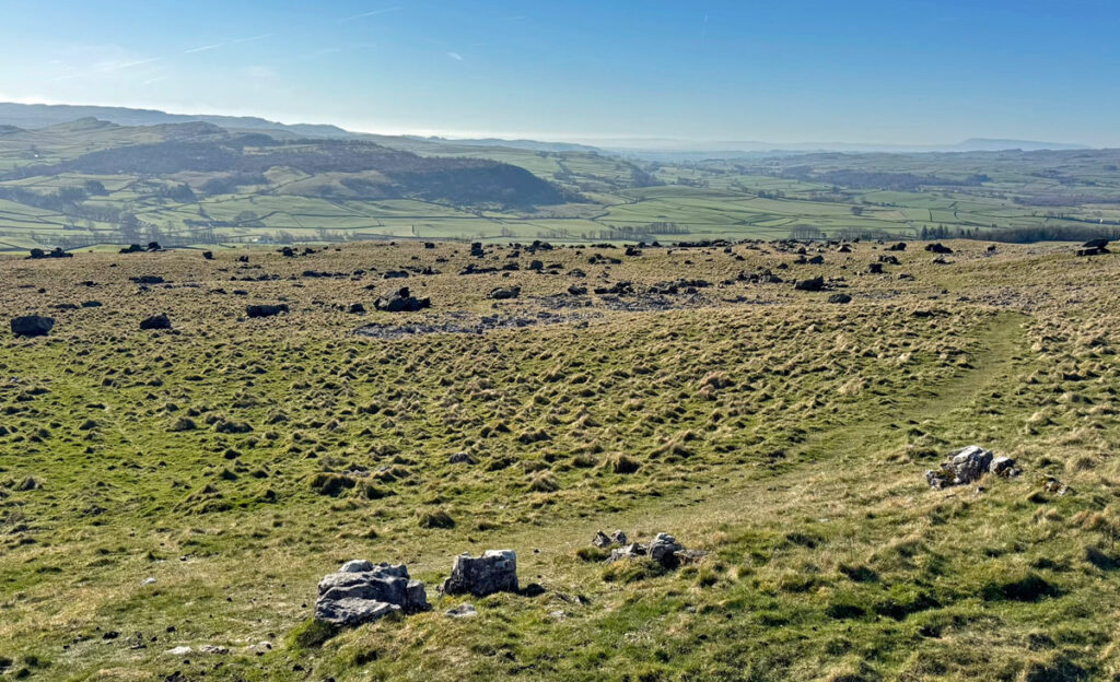
If using this path from Horton, you begin by crossing fields, then progress onto the Sulber limestone pavements that form a constituent of Ingleborough’s NNR, before meeting the route up from Norber. Using this junction as a springboard, a fine circuit can be enjoyed by taking the path described above one way and linking it via Long Scar to the Clapham/Little Ingleborough path at Trow Gill.
Ingleton is the base for another popular out and back route. The first half is along a walled track (unsurfaced) known as Fell Lane. This leads to open country at Crina Bottom, the farmhouse here having been built in the 1630’s and recently renovated by its last owners into a bed and breakfast establishment (although with no mains facilities). The house was put up for sale in 2024 at a price of £750,000. At the time of writing (June 2025) I have not found any evidence that it has been sold.
The onward route from Crina Bottom is clear and progressively steepens for the final rough section onto the plateau.
The only alternative for a varied return to Ingleton is either to drop towards Chapel-le-Dale and follow back under Raven Scar, above White Scar Show Cave, or to walk along the top of White Scars, which is a mostly pathless option, although with a fine situation.
Finally, to Chapel-le-Dale for what is the shortest ascent of Ingleborough, although eminently extendable into an excellent circular walk. The direct route crosses fields and then the damp ground of Humphrey Bottom, much assisted by wooden boards, before a steep zig-zag climb to the ridge. It’s a quick, straightforward and enjoyable ascent.
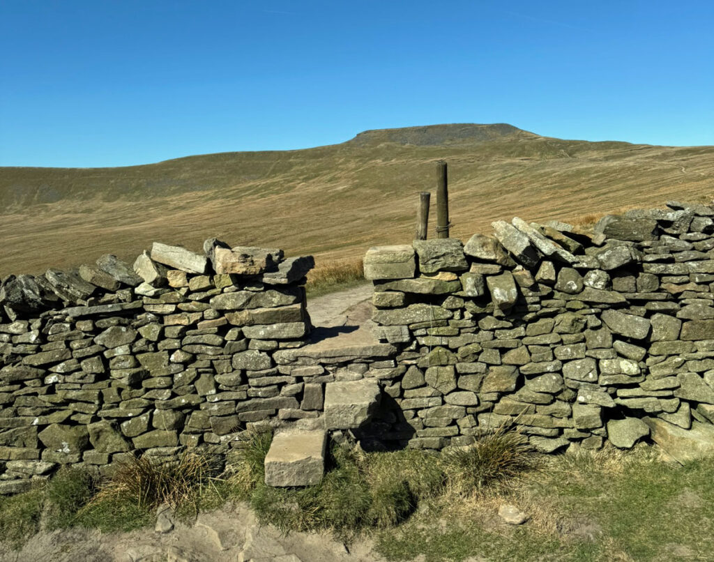
The alternative for a round trip involves the northern extension of Ingleborough to Park Fell. This can be accessed in several places, all involving a steep climb (or descent) to the escarpment, alongside the walls on its flanks. It is, nonetheless, well worth it as, in my opinion, this is the escarpment is most atmospheric location on the mountain. There is also the option to explore the rarely visited and magnificent limestone pavement of the Souther Scales Nature Reserve (not far above the road at the Old Hill Inn), which is entirely enclosed to preserve it from grazing. It’s like a miniature lost world. Access into the reserve is by stiles on its upper side, so it can be approached either by the track to the north or from above Great Douk Cave.
The Summit
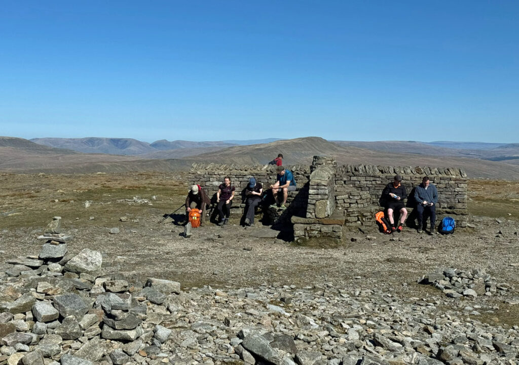
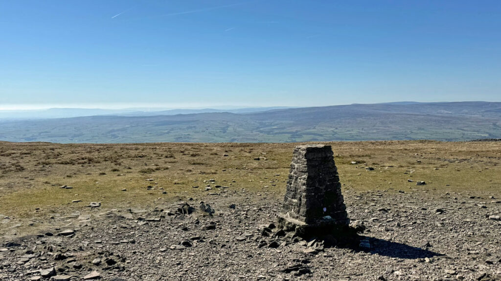
Whichever route takes you to the summit, you will enter an extraordinary space. The gently sloping, short cropped plateau is composed of millstone grit, roughly half a mile in circumference and devoid of anything natural except stone, most of that rearranged by the human hand. There is the OS trig pillar, a cross-walled shelter surmounted by a view indicator and there are cairns and other sundry piles of stones. The summit plateau is a prehistoric site possibly dating back four thousand years and formerly enclosed by ramparts around the majority of the circumference, exhibiting the remains of around twenty circular stone constructions within.
The natural assumption is that the summit was developed a hillfort, in fact it would have been the highest in England, however, the ramparts appear to have been too weak and inconsistent for defence and there is a strong possibility that the site actually served for ritual purposes, the stone circles being ring cairns not domestic huts.
The Three Peaks
The circuit of the Three Peaks (now generally known as the Yorkshire Three Peaks due to other such challenges around the country) involves a twenty-four-mile walk and over five thousand feet of ascent. The idea is to achieve this is under twelve hours. The traditional starting point is Horton-in-Ribblesdale (mainly for availability of parking), taking an anti-clockwise circuit, beginning with Pen-y-Ghent, which is a very easy ascent. The longest part of the route then follows, even longer now due to footpath rerouting to avoid boggy sections, and it feels like an endless (but drier!) trudge to reach Ribblehead for the ascent of Whernside. For most people this is the most dispiriting section of the walk.
Ribblehead is named as being at the head of the River Ribble, although this is not quite accurate as the source of the river is higher up, on the western flank of Cam Fell, where a couple of springs mark the highest point. Nevertheless, it is the area around Ribblehead where the river begins to become more distinct. The iconic railway viaduct spans Batty Moss which provides the original and much lesser-known alternative name.
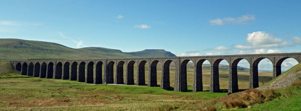
The ascent of Whernside runs alongside the full length of the viaduct, then follows a pleasant and straightforward path to the summit of Yorkshire’s highest mountain. From here the views to Ingleborough are spectacular. The descent to Chapel-le-Dale is short and steep and then we are back on familiar ground for the ascent of Ingleborough.
The walk is very popular as a charity fundraising challenge and therefore there is an attempt to regulate the high numbers taking part. The Yorkshire Dales National Park Authority publish guidelines and a code of conduct for those organising a walk. You can also download a certificate on completion of the Three Peaks or even just Ingleborough alone, and a commemorative medal can be purchased!
The Three Peaks is also run as an annual fell race with winners completing the course in three hours, which is rather demoralising for us ordinary walkers struggling to finish in twelve!
Worthy Rating: 76
Aesthetic – 24
Complexity – 15
Views – 14
Route satisfaction – 14
Special Qualities – 9