Tinto – Hill of Fire
Tinto is the prized mountain of South Lanarkshire, the Sunday afternoon ascent for thousands of local families, with its imposing bulk providing a background view to their daily grind. Tinto is certainly a distinctive presence, a vast, solitary dome rising above a loop in the River Clyde to a height of 2,334 feet (711m). Having said that various heights are recorded because the summit is made artificially taller by one of the largest round cairns in Scotland, created by countless hands over four thousand years ago during the Bronze Age. The adjacent Trig Point is measured at 2,320 feet (707m) with both heights being printed on OS maps!
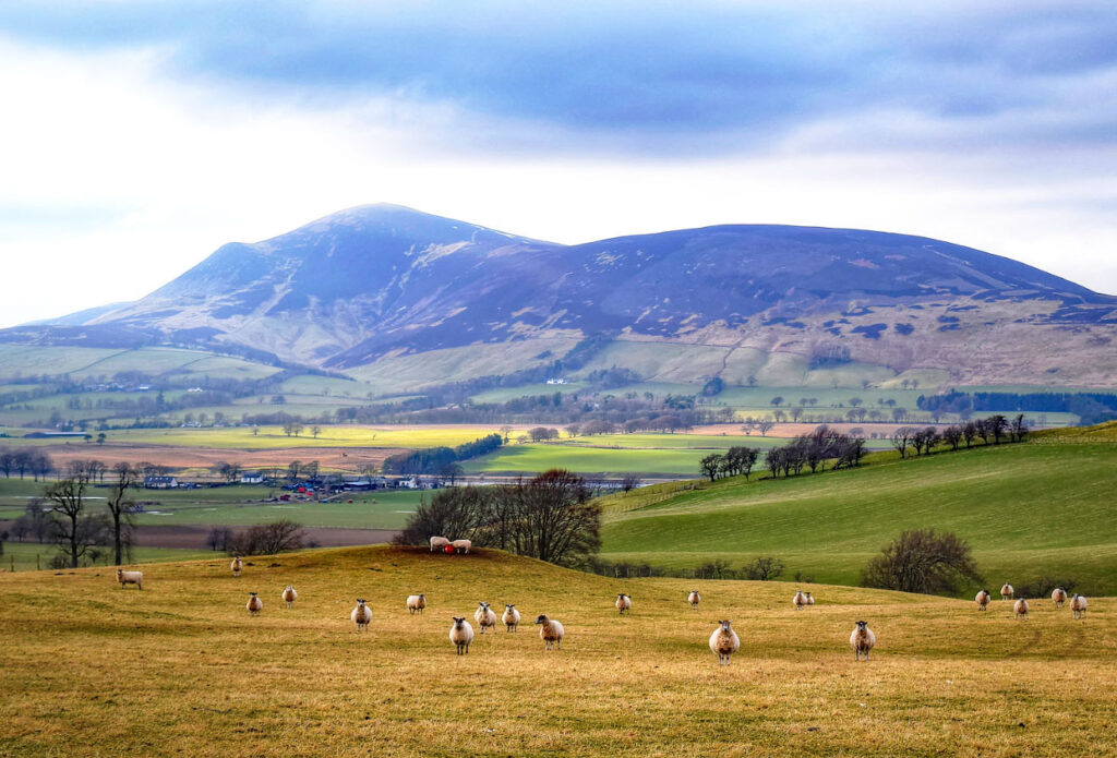
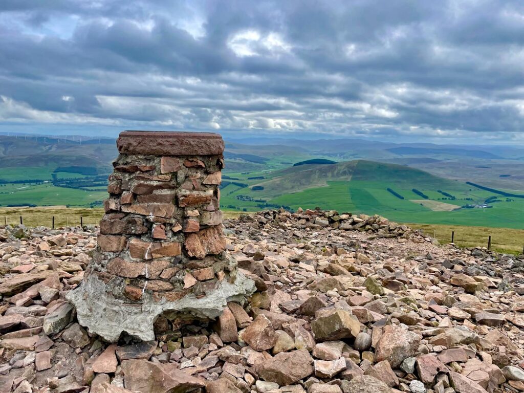
Tinto ‘Cairn’ is an astonishing 148 feet in diameter and 20 feet high. What lies within we can only guess, although it is constantly growing, for local tradition decrees that a stone should be carried from the foot of the mountain to the summit on every ascent, although this is not perhaps widely known as few actually adhere to the request.
The map can be zoomed in or out to change the scale
Tinto was clearly held in much reverence in ancient times, the summit cairn being precisely aligned to the setting of the midwinter sun when viewed from a burial site on Black Mount hill to the north east. On the lower slops of Tinto is Fallburn Hillfort, over two hundred feet across and built during the Iron Age around three thousand years ago. It’s most unusual to find a hillfort not on the top of a hill, which was customary for maximum defence strategy.
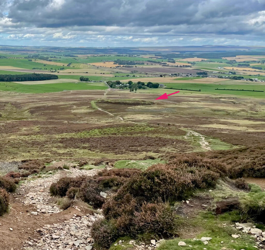
What’s in a name? Tinto is really just an abbreviation for Tinto Hill, Tintoc Hill and Tinto Tap, all deriving (probably) from the Gaelic ‘Teinnteach’ meaning fiery. This itself may come from the use of the hill as a beacon or the red Felsite summit rocks. Felsite was locally quarried and used in road surfacing – the ‘red roads’ of Lanarkshire formerly being a renowned feature of the district.
Of course, Tinto is also a grape variety fermented into red wines, so if you use the hashtag #tinto on Instagram after climbing the hill it won’t be seen by hill walkers who employ #tintohill instead – and plenty do, with the hill having received over 7,000 tags.
Although commonly thought of a single hill, Tinto comprises five tops, four spanning an east to west ridgeline with an offshoot to the north. It is from the north that the usual ascent is made, being the least steep and with the most well-trodden path, although other ascents are possible. The south side presents the sharpest angle with the sketchy path from Whiston Lodge taking agonizing zig zigs as it climbs the nose of Pap Craig, one of the few places where the bedrock of Tinto is naturally exposed. This is the shortest route to the summit. An approach along the ridge can be made from the west at Howgate, which passes pleasingly over Lochlyoch Hill; or alternatively from Cleugh Reservoir climbing the spurs either side of Cleugh Burn. Cleugh means ravine and well describes several features of this name, being deeply incised glacial meltwater channels cleaving the lower slopes of the hill.

The northern approach doubtless resembles a colourful jamboree during summer weekends when inadequately clad hordes clamber up in disjointed chorus. I’m sure it’s a happy party atmosphere. I felt I could detect an echo of that bustle on my ascent on a midweek day in September, while taking a break from the M74 when driving from the Midlands to the Highlands. Tinto stands resolutely in the way, forcing the motorway to deviate around its western slopes. It is this sheer presence that partly elevates an otherwise unspectacular hill into the realms of the Worthies. I have looked at Tinto for probably fifty years while passing, wondering what it would be like to stand on the summit, so an ascent was long overdue!
The approach off the M74 from the south onto the A73 gives a fine prospect of the hill, showcasing its steepest slopes, although this was not to be my means of ascent. I chose the most popular route to share the same thrill that attracts the Lanarkshire masses who make the climb. The sizeable car park on the edge of the hamlet of Fallburn is no doubt insufficient on busy days, although on my arrival there were just two other vehicles. The rising slopes above the car park were almost as appealing as those from the south, with the summit cairn clearly visible. The hill is a fine sight from every angle. Tinto may stand at a goodly height over 2,300 feet, but the starting point bites a chunk from the ascent, itself at an altitude of over 700 feet, leaving just 1,600 feet to climb over a distance of two miles. That sounds pretty easy and it is, nevertheless, I am sure many customarily sedentary Sunday strollers underestimate the effort involved, particularly as the convex nature of the terrain results in false summits nearer the top, a demoralising experience for the unfit. The path is worn to gravel in places but, considering the boot (and block heel!) bashing it takes, it weathers the traffic surprisingly well.
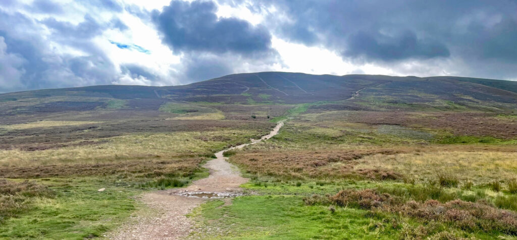
The route is never really in doubt, commencing as a grassy avenue, gently graded to ease you in. Making fine early progress it is very easy to miss the Fallburn Hillfort on your left, although less so on the descent when it is more obvious from above. Beyond, as the ground steepens the path becomes an obvious scar on the hillside, becoming progressively more red as the Felsite is revealed. Progress is rapid until a choice of paths presents at a higher level. To the left the route climbs over a small knoll, while straight ahead it slants across screes. The paths meet again a little later. After this, the promise of the summit tantalises, but even when you know there are false summits they still manage to dent the anticipation. For those unaware wheezing townies it must be a severe blow. Nonetheless as Billy Connolly just to say ‘it’s character building’! Even more so for the fell runners who tackle the annual Tinto Hill Race, although they are mostly seasoned participants and know to what to expect. In actuality, the runners do not follow the main path at the top but an unmarked course across the high ground. I wonder if that is deliberate to avoid false summits or to protect the more fragile upper path surface. The race takes place each November with around three hundred entrants and a return time of under twenty-nine minutes has been achieved. It takes many people more than three times that just to get to the top!
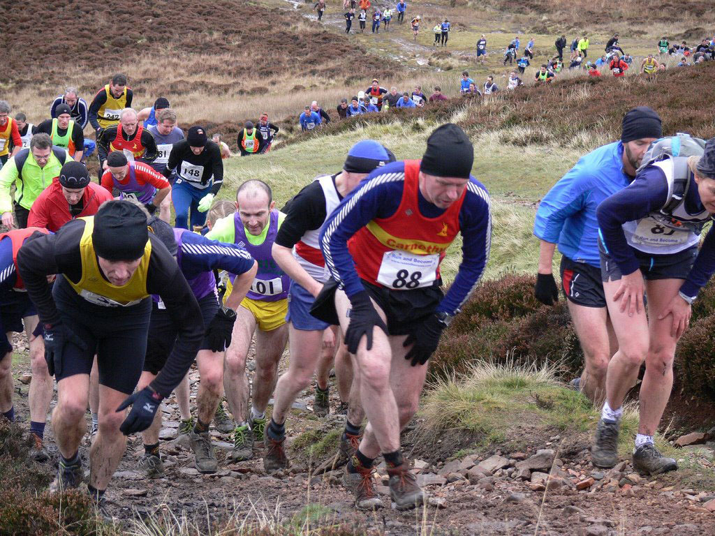
Photo: https://jdswanderings.blogspot.com/2008_11_01_archive.html
The final ease of gradient brings the massive cairn into view and with it the joy of a splendid panorama. You knew all along that Tinto would be a good viewpoint, standing high, proud and isolated.
This view had awaited me for fifty years and apart from the plethora of wind farms on the neighbouring hills to the south it will have little changed over that period.
The clamour of activity on summer weekends as the marauders jostle for position on the cairn was thankfully absent for me and new prospects of hills opened up in an arc from the Pentlands, through the whole of the Southern Uplands to distant outlines of the Highlands. On crystal clear days it is possible to see from Skiddaw to Lochnagar.
Undoubtedly Tinto is an overlooked ascent for most non-local people and that is an important reason for the hill’s inclusion as a Worthy. Despite being a familiar sight to the hillwalker driving along the M74, few will bother to stop and climb it, instead intent on the Highland escapades beckoning ahead. The denizens of South Lanarkshire know it well and some of them will have drunk beer on the top. You are missing out, although maybe not on sharing warm beer. However, pick a quiet day and factor in a few hours for this detour with a difference into your next itinerary. It’s a refreshing change.
Worthy Rating: 68.5
Aesthetic – 22.5
Complexity – 12
Views – 15
Route Satisfaction – 12
Special Qualities – 7