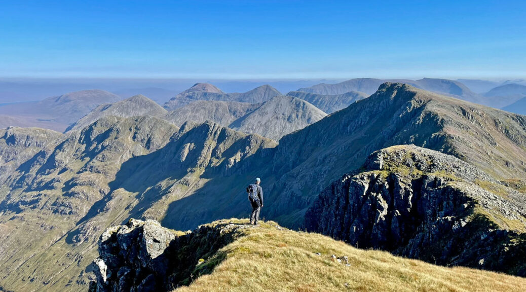
Bidean Nam Bian – Pinnacle of the Mountains
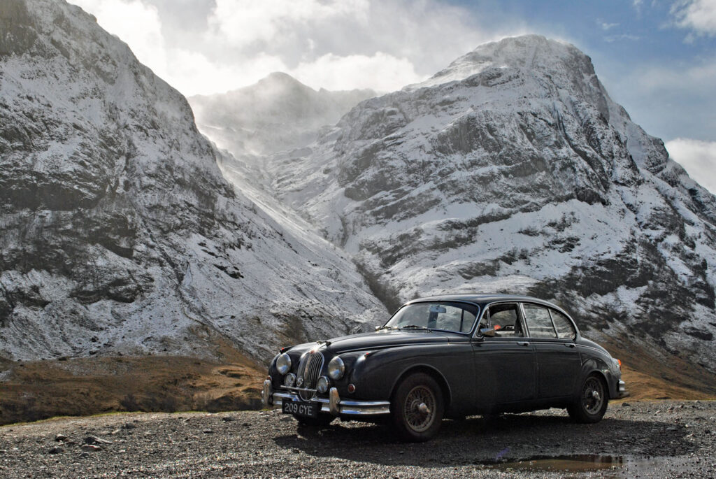
This is the highest and most complex mountain in Glencoe standing at 3771 feet (1150m), with multiple ridges that sprout nine individual summits. The loftiest top is bashfully concealed behind the monumental spurs of three of these ridges, The Three Sisters, which themselves form the most celebrated view in Scotland’s most revered glen. In fact, Bidean nam Bian comprises the whole southern side of the glen, from the curve of the A82 at Achnacon rising to the Glencoe Waterfalls at the valley head, arranged in one vast jumbled massif.
Bidean nam Bian, like many Gaelic names, translates more on a theme than a specific definition. Here it is ‘Pinnacle of the Mountains’ or ‘Peak of the Bens’, each proclaiming the hill’s sovereignty of the district. Originally the nine summits yielded a single Munro, although when Sir Hugh Munro compiled the list in 1891 his lack of objective criteria subsequently led to considerable debate and some later amendments. Stob Coire Sgreamhach was promoted to Munro status in 1997 bringing the Bidean’s tally to two.
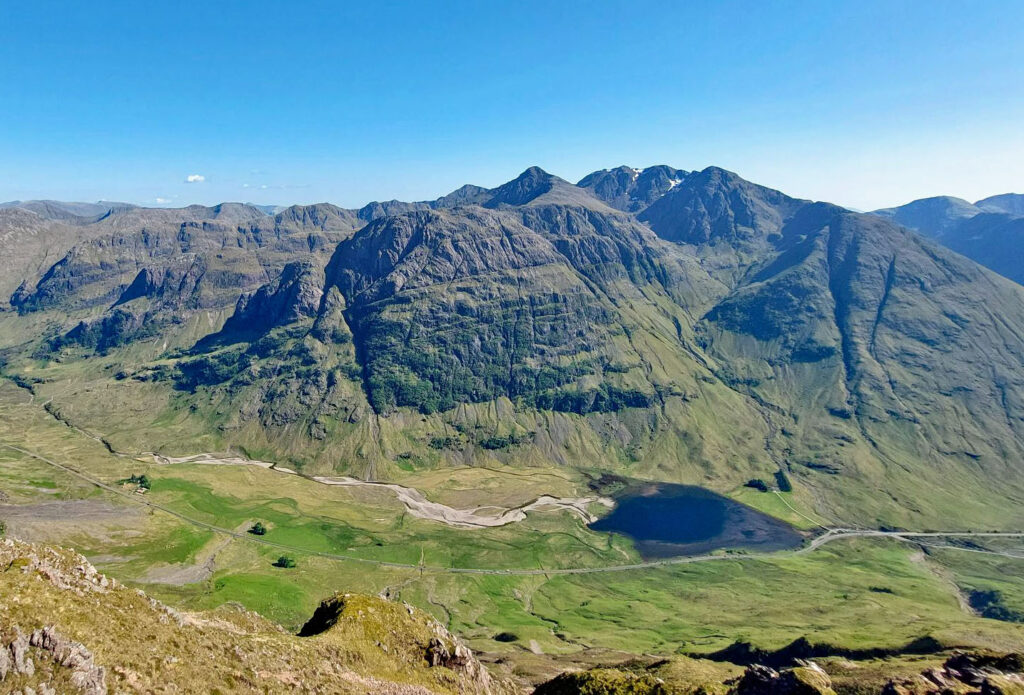
There are over thirty recognised ascents of Bidean nam Bian, in fact a guidebook solely to this range was written by David Unsworth (Greenburn Publishing). Most routes commence in the Glencoe valley, this being the most spectacular aspect, leaving the south and west flanks much less frequented. For the generations of travellers emerging from Rannoch Moor, who have gasped at this revelation of Glencoe where the A82 rounds a corner by the Glencoe Waterfalls, it is Bidean they are looking at; their vision transfixed by the projecting mass of truncated ridges that define the southern enclosing wall of the valley. And what a wall it is, powerfully thrusting towards the sky.
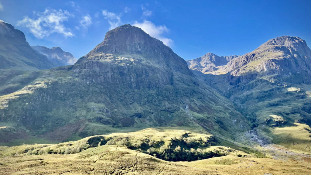
This imposing triptych of mountain sculpture is the Three Sisters, which comprise the exalted scene from what is known as The Study, not named as might be thought for being a place to study the view, but after a flat-topped rock on the former road above, called the ‘Stiddie’, itself an old Scot’s word derived from the Gaelic for Anvil.
Close by are two large laybys that cater for both walkers and passing tourists, so space is always in high demand. It is worth noting that the lower layby is now exclusively reserved for coaches, whose passengers are entertained by the melodia of enterprising bagpipers. The sounds of the pipes drift high onto the mountain during your ascent, although the pleasing echoes are somewhat ruined when a rendition of ‘happy birthday’ is requested by an eager traveller.
The map can zoomed in or out to change the scale
There are three major routes of ascent from the north side, the walking routes taking the valleys between The Three Sisters and scrambler’s options ascending the ridges. Using the upper car park the standard outing is a seven-mile circuit via Coire nan Lochan and Coire Gabhail in whichever direction. The other popular ascent is from lower down at Loch Achtriochtan, one of few places where the actual summit can be clearly seen. The route takes a good path beside waterfalls into Coire nam Beithach (Corrie of the birches – although few birch trees exist these days). From there, the modern path heads right onto Stob Coire nam Beith, or an alternative route branches left up to the upper reaches of Aonach Dubh, below Stob Coire nan Lochan. For scramblers, Aonach Dubh, the ‘sister’ above the Loch, can be climbed by Dinner Time Buttress, a route I last experienced as a winter ascent in 1983. Unfortunately, I can’t remember anything about it now, although my notes from the time record it as excellent.
What I do remember about Aonach Dubh is Ossian’s Cave, a one-hundred-foot vertical slit in the crag clearly seen from the road. The cave was first reached by a local shepherd in 1866, who discovered the floor to be sloping at an angle of 45 degrees. Or maybe the shepherd was not first, as legend will tell you that the Celtic hero Ossian was born in the cave, admittedly an unconventional place for his mother to venture to bear a child. At some point, remarkably, a metal box containing a visitors’ book was positioned in the cave, although later stolen. A new one was placed there in the 1970s, also subsequently stolen.
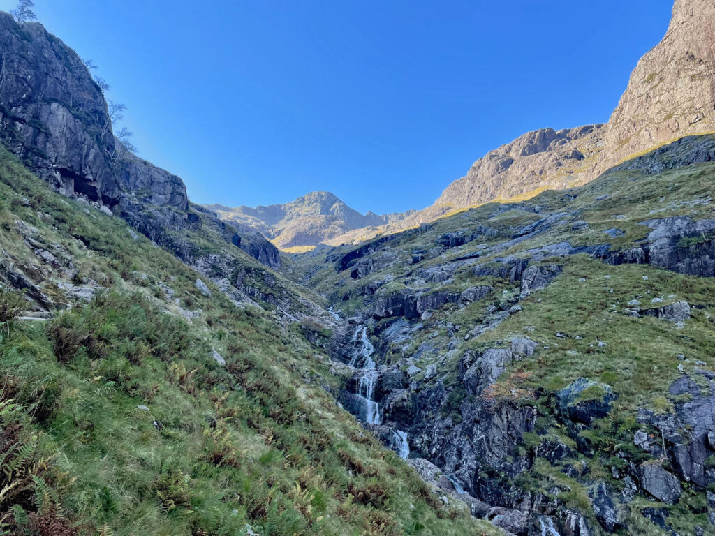
My most recent ascent of Bidean Nam Bian to capture photographs for this feature was from the upper layby taking the circuit mentioned earlier. This may be a mere seven miles and mostly on much improved paths, yet it takes most walkers around eight hours, although being blessed with superb weather, for me photography also accounted for a fair portion of this!
The path into Coire nan Lochan has been transformed by stone pitching and feels far easier than the rugged terrain would suggest. High in the corrie, the new path takes the more direct route, leftwards above the central sister, Gearr Aonach, followed by a steep but easy scramble to the summit of Stob Coire nan Lochan. Again, there is a scrambler’s option for Gearr Aonach, in the form of the Zig-Zag ‘path’. This begins in tandem with the route into Coire Gabhair described later.
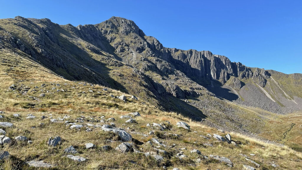
For the walkers in Coire nan Lochan, many ignore the new path heading left and instead turn right onto north ridge running from Aonach Dubh, which was always regarded as more scenic, although with less of a defined path. If you go this way, there is a little easy scrambling on the ridge and be sure to look out for the ‘Pinnacle’ at the start of the crags above the corrie. Whichever route you have taken the top of Stob Coire nan Lochan is a welcome sight.
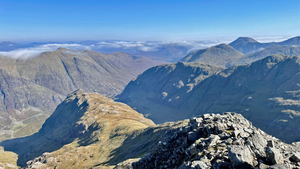
From the boulder strewn summit, the previously retiring top of Bidean nam Bian is fully revealed. Try not to be concerned that the lower part of the connecting ascent to Bidean looks intimidating from here, as it’s no more of a problem than anything that has gone before. A path avoids any difficulties by keeping right of the crest and soon you will be on the thrillingly pointed roof of Glencoe.
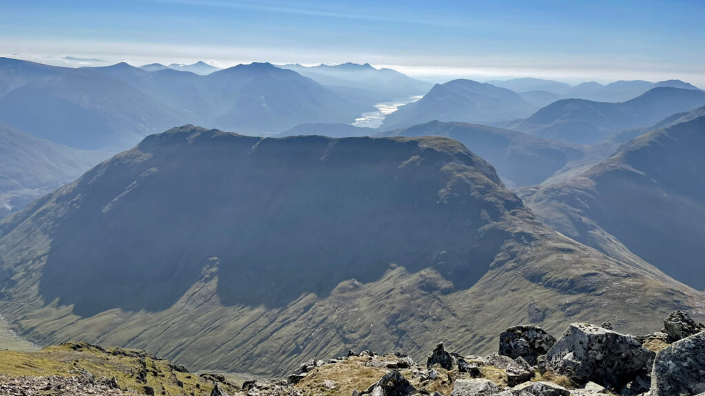
The draw of Bidean nam Bian is immense. For many people this is their ultimate mountain and a major part of this is its relative accessibility. No climbing skills are required, although a fair degree of fitness and some confidence on exposed ground is recommended. Obviously in bad weather or winter conditions the traverse of the mountain becomes a much more serious undertaking.
All tops share rewarding views, although each offers a unique, exclusive panorama of varied mountain ranges and close up views of neighbours. As such it is worth the extra mile return walk (time permitting) from the main top around to Stob Coire nam Beith. From here there is a breathtaking prospect of the crags beneath the summit of Bidean, in particular the massive Church Door Buttress.
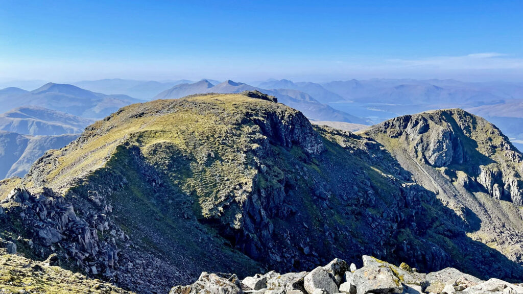
Back on Bidean’s main summit, the descent to Bealach Dearg is a fair drop but without any difficulty, the view of Coire Gabhail opening up with each step. This awesome glacial hanging valley appears to go on forever and considering this may be your route home, the day is clearly long from being over. Ahead is Stob Coire Sgreamhach, formerly merely a Munro top, but now ascended much more often since its elevation to full Munro status. Sgreamhach is lower than the other contenders of Stob Coire nan Lochan and Stob Coire nam Beith, but is separated by greater distance and prominence.
I am one of those guilty of not climbing Stob Coire Sgreamhach before it achieved Munro status and what a fool I was. Not only is it a straightforward walk from Bealach Dearg but in some ways its views are even finer than from Bidean’s main summit, particularly in the direction of the two Buachailles.
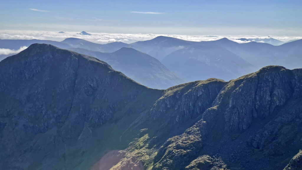
The Bidean massif can also be traversed by using the car park for Buachaille Etive Beag (above the Glencoe Waterfalls). In this case Sgreamhach is ascended first, either by following the Lairig Eilde or by ascending the blunt nose of the third sister, Beinn Fhada, then continuing along the extensive ridge. Crags on the nose can be avoided, although much higher up, after the summit of Beinn Fhada, there is a ‘bad step’ on the final climb to Sgreamhach, although this can be circumvented by rock steps to the left, so is not to be feared. Incidentally, Lairig Eilde runs from Glencoe to Glen Etive over a high pass with a river on each side, although curiously both have the same name (Allt Lairig Eilde).
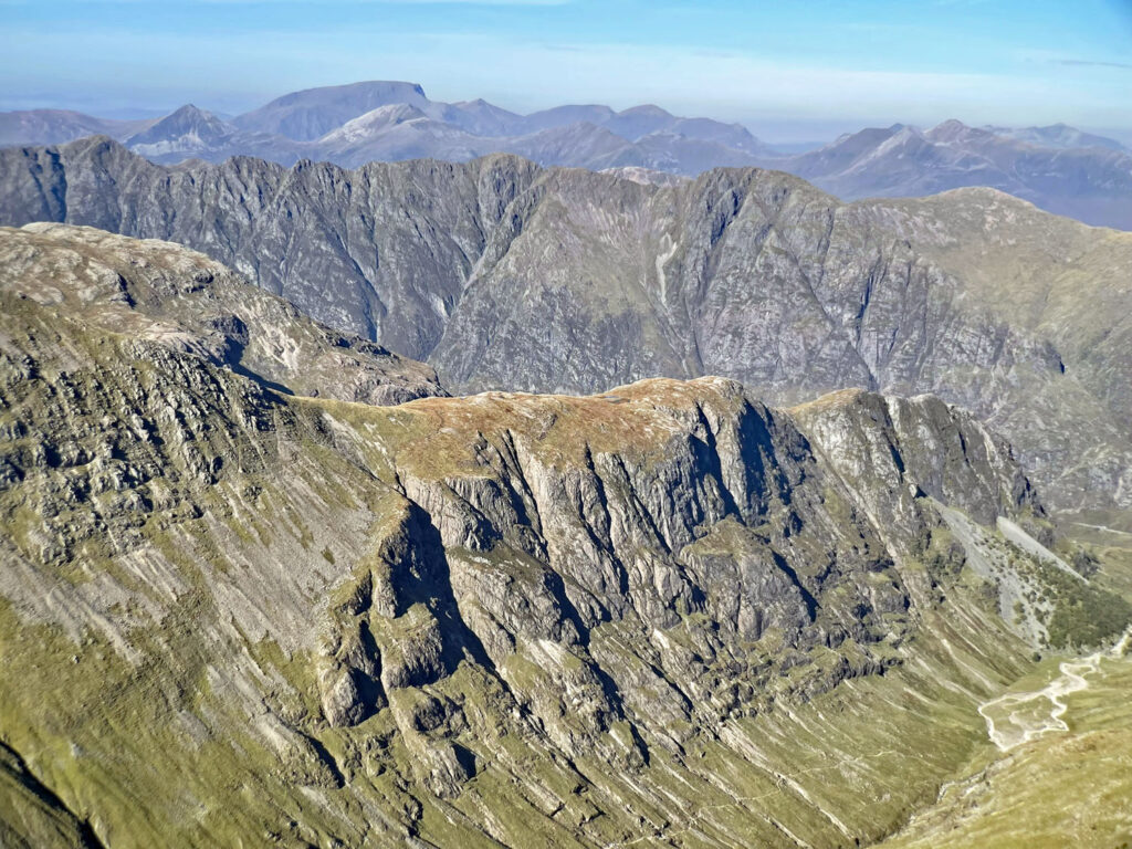
You will have already been thinking about the name Sgreamhach and doubtless pronouncing it as ‘scream’. Interestingly, the Gaelic translation is not that dissimilar for it means ‘Peak of the dreadful corrie’ (also loathsome, horrible or similar – you get the gist). Incidentally, the correct pronunciation is more like Skrem. However, take a look at the map; can you find the Coire Sgreamhach after which the peak is named?
My speculation is that the summit would normally derive from its main corrie, which in this case is Coire Gabhail and thus the corrie itself may have been renamed. Coire Gabhail is another mixed translation, meaning ‘Corrie of capture’ or ‘Hollow of bounty’, neither of which are specifically on the fearful theme. In modern parlance the corrie is usually called the Lost Valley or the Hidden Valley, which refer to it being concealed from view when travelling through Glencoe. Due to this, the notion persists that the Clan MacDonald hid cattle there (whether owned or plundered), which would explain the ‘capture of the bounty’. Indeed, the high mountain meadow occupying the valley floor would make an ideal grazing location, although considering the rough terrain leading into the corrie, one has to wonder how cattle were driven to this place.
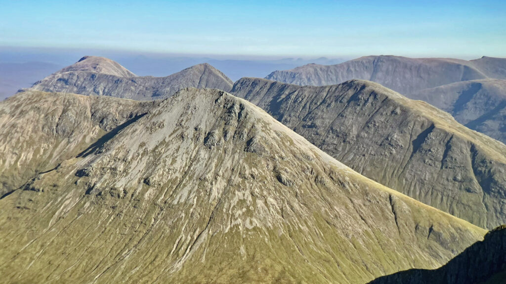
If descending from Bealach Dearg into Coire Gabhail, the initial slopes are steep and unstable. A slanting path through scree is unpleasant at first but the angle soon eases and matters improve. At the foot of the valley the river disappears underground, to remerge at the narrow outflow of this fascinating hanging valley. Whether cattle were kept here or not, it was certainly a territory of the MacDonalds and used for hiding in a different fashion on the day of the treacherous Massacre of Glencoe. In February 1692, fleeing clansfolk escaped to the hills, seeking safety amongst the huge boulders and caves created here by what is regarded as one of Britain’s largest natural rockfalls, triggered at the end of the last ice age some 12,000 years ago. It is likely that a lochan once occupied the floor of the valley, a legacy of glacial meltwater but, like the river, it seeped away.
Despite its robust appearance this formerly hidden place is under pressure from tourists and you may encounter day visitors disturbing the tranquillity of this haunting location, along with the tents of wild campers, all attracted by the historic romance of the Lost Valley.
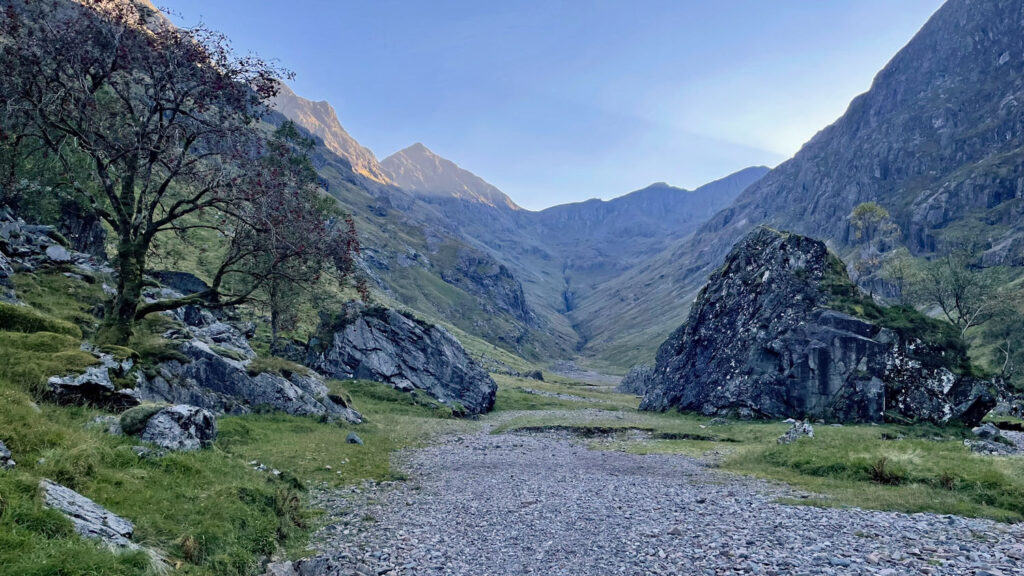
The path briefly rises above the outflow, then descends into an ancient mixed woodland protected from deer grazing to allow regeneration. Unfortunately, wild campers are less controlled and regularly cut branches to use on camp fires.
It is only when the road through Glencoe is seen below that the true hidden nature of the Lost Valley is understood because there are still some 800 feet over one mile to descend before the River Coe is crossed. This is achieved by means of a curious footbridge built as though for giants. It was constructed in 1966 by Royal Navy Apprentices and I’m not sure if it replaced an earlier structure, although W.H. Murray, who recorded many climbing ascents in Glencoe, recalled having to wade the river to access the crags in the 1930s.
From the bridge, the prospect upstream is of the Meeting of Three Waters, where three rivers converge at right angles. The name is erroneously but almost universally applied to the Glencoe Waterfalls on the River Coe half a mile beyond. Sadly therefore, most visitors never actually see the true Meeting of Three Waters.
Nonetheless, by the time you reach this point and somewhat wearily make the short climb back to the car park, the piper will likely have long since departed and you’ll be relieved to not have negotiate the presence of tourists anyway!
Worthy Rating: 90
Aesthetic – 27
Complexity – 18
Views – 19
Route Satisfaction – 17
Special Qualities – 9
2 thoughts on “Bidean Nam Bian – Pinnacle of the Mountains”
You remind me what a great mountain range this is. I don’t think I have done it since my first walking trip to Scotland with Mike and Nick in April 1980, when I had my 16th birthday the day before the ascent. We had a similarly wonderful day, and noted the steepness of the ascents and descents.
Many paths have been improved since that time so the going is much easier these days, although to counter that we are are rather older!