
High Cup Nick – A Pennine Wonder
High Cup Nick is a landscape feature, not a hill, however it occurs on a high escarpment where surrounding summits are of marginal additional altitude and therefore it feels like a hill. Moreover, it’s a unique and compelling upland cynosure and, in my book, that makes it worth travelling to see. Despite the rating of 64 High Cup Nick therefore gains Worthy status.
A combination of geology and glaciation have created this crag rimmed valley deeply incised into the western scarp of the Pennine hills. Some people aggrandise High Cup Nick as ‘Britain’s Grand Canyon’, which is frankly preposterous and rather embarrassing, particularly in the company of anyone who has been to Arizona. Such a headline may attract the odd gullible reader to a blog, although naturally I wouldn’t try that on you…
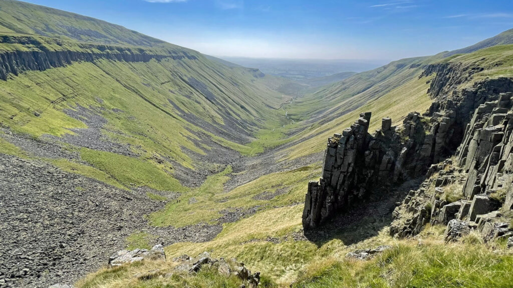
The Ordnance Survey refer to the valley as High Cup Gill, others abbreviating this to High Cup, as the ‘Nick’ is officially a cleft just north of High Cup Head (the axis point of the escarpment), although most people use High Cup Nick as the all-encompassing name. To add further nomenclature, the craggy sides are called High Cup Scar and the stream is High Cupgill Beck. We are not done yet because the flat, boggy terrain beyond the Nick is High Cup Plain, the place that feeds the beck, even though it does so subterraneously. This is indeed an intriguing place!
I first encountered High Cup Nick as a fourteen-year-old, whilst walking the Pennine Way. I was mightily impressed by this remarkable geomorphological feature (I was big into Physical Geography at the time and Geomorphology was my favourite part of the subject). I remarked that it was so much bigger than it appears on the map, which is unsurprising, as at that age I couldn’t afford many maps and purchased the smallest scale to cover the maximum area per pound sterling!
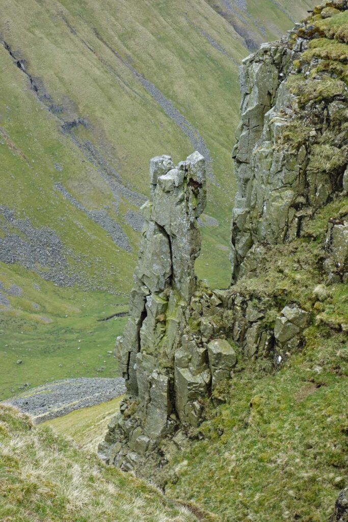
Nonetheless, my journal recorded disappointment with Nichol’s Chair, a rock pinnacle I had eagerly anticipated through gazing at Wainwright’s drawing in the guidebook. It was somewhat shorter and fatter than the slender tooth depicted and I found the rock around it to be unstable so did not attempt to climb it. Few others have since that time either, as there are still only a handful of recorded rock climbing routes on two kilometres of continuous crags. The rock is generally regarded as too loose for safety. Incidentally, the curious Nichol’s Chair is eponymous, so christened after a local cobbler who reputedly re-soled a pair of shoes whilst standing on the top to satisfy a bet.
Whin Sill
The escarpment of High Cup Scar is one of several renowned exposed formations of a monumental volcanic intrusion stretching across northern England, where instead of being ejected, molten rock under pressure was effectively injected between layers of sedimentary rocks, then slowly solidified over around fifty years to leave a series of columns composed of dark, hard rock known as dolerite. Other celebrated features of the sill are High Force just a few miles east of High Cup and Crag Lough on Hadrian’s Wall to the north.
The map can be zoomed in and out to change the scale
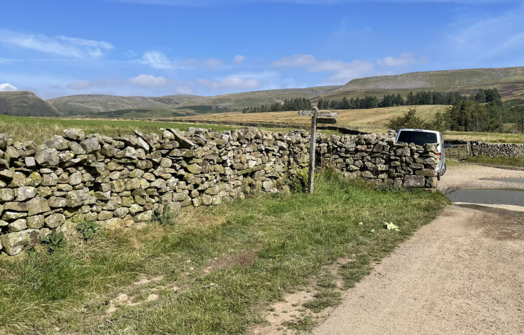
The popular ascent utilises the Pennine Way long distance footpath from Dufton. Do not miss a stroll around this charming and unspoilt village with former lead miner’s cottages set around a spacious green. Some road walking can be avoided by following the lane past Bow Hall Farm, where there is parking for several cars at the end. This also opens up the possibility of taking the path following the fence line southwest to Keisley, thus providing the shortest circular route (study the map above).
Alternatively, also from Dufton, there is a path behind the shapely Dufton Pike (itself worth a visit as a separate short walk) up Great Rundale Beck onto Blackstone Edge, which feels more like a genuine mountain walk and gives the chance to reach a trig point. It is, however, a much tougher walk than via the Pennine Way.
Finally, the Nick can be approached from the east at Cow Green Reservoir with a starting point at over 1,500 feet. This follows the Pennine Way from the opposite direction and is a gentle but longer out and back walk. A bonus is the sight of another natural wonder, Cauldron Snout, an extensive water cataract (the longest ‘waterfall’ in England!) again owing its existence to Whin Sill.
Returning to the popular Pennine Way ascent from Dufton, note as Bow Hall Farm is passed that the buildings are backed by a shelter belt of trees in an unusual location. Prevailing winds in Britain are from the southwest so why would the eastern side be chosen for protection? The answer is another local, although ferocious curiosity known as the Helm Wind, which can reach speeds of up to 80mph. It occurs when northeasterlies blow then suddenly plunge over the escarpment to be disturbed by warm air rising from below, creating a devastating circular motion.
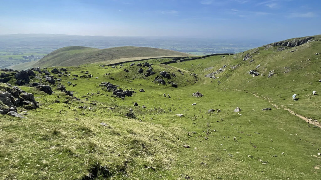
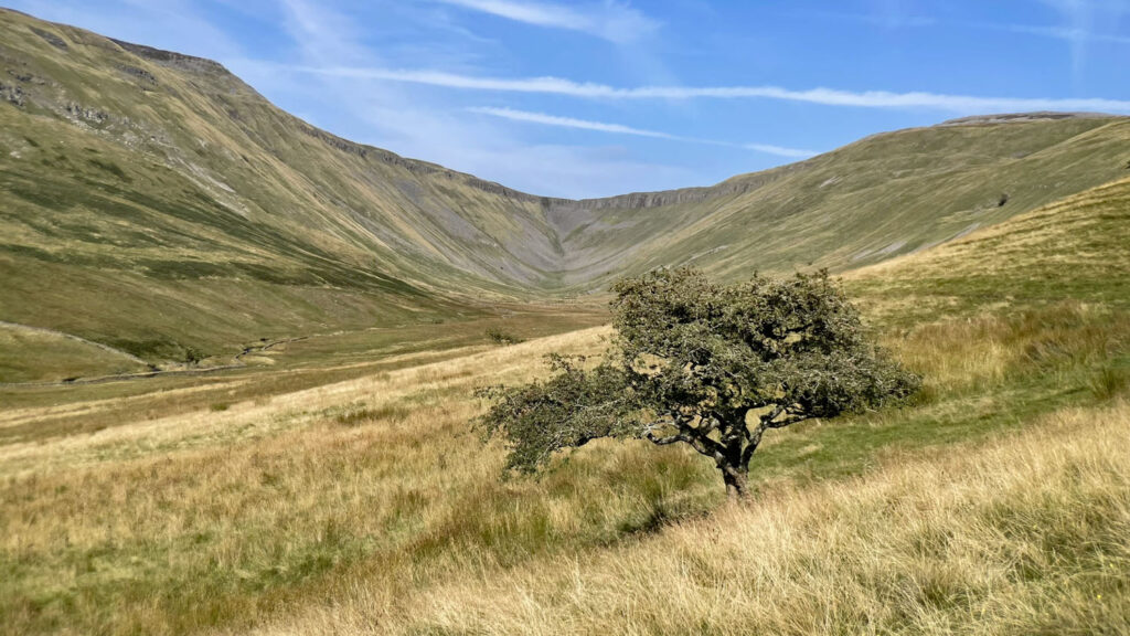
As height is gained, the road becomes a stony cart track then dwindles into a far more pleasant grassy path. Interest is stimulated by a grassy hollow scattered with limestone boulders, shortly followed by tantalising glimpses of the main event to come. The major ascent is now over and your focus will be on the developing views of High Cup. It really is a wonder of the glacial age; a classic U-shaped valley scoured by the inexorable flow of ice.
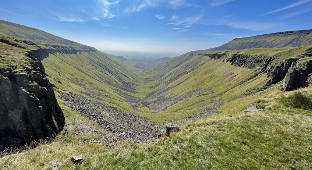
Once the Nick is reached there are choices of return. Most people go back the way they have come as social media did not offer them alternatives. A circuit of the valley is a fine option with a path looping round above the crags on the south side before descending Middle Tongue to Harbour Flatt farm. Or a higher path traverses the shoulder of Murton Fell before diverging towards Murton Pike for those who wish to add another summit. The third option and the one I recommend for variety is the descent into the depths of High Cup itself.
From the top, a sketchy path can be seen way below. Connecting yourself to this is the tricky part. Do not go down the obvious scree (although some do). Instead retrace a few steps and from the edge a steep path can be found. It isn’t as bad as it looks and the gradient soon eases, then just keep to the grass on the right of the main scree. This is a powerful place to be, surrounded by a threatening cirque of impenetrable crags, although be warned, if you do stumble and curse loudly this will echo around the natural rocky amphitheatre.

Suddenly the beck appears from underground, a common occurrence in limestone landscapes, where the water has trickled down from High Cup Plain above, through crevices and boulders. Follow the path more gently and go through a wall then trend left away from the beck, maintaining height. The temptation is to follow the beck as it gently descends but the ground soon becomes boggy.
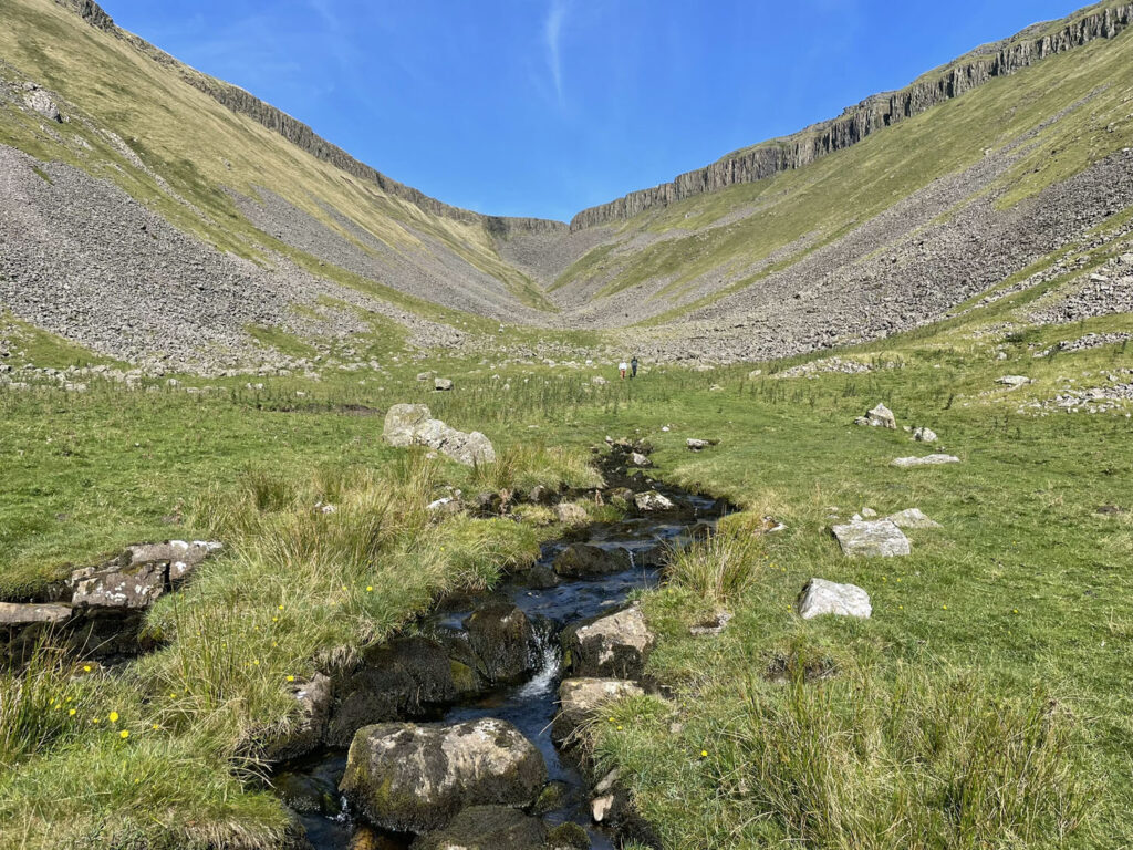
Another constant temptation during the descent is to repeatedly turn around and admire the ever-widening scene of High Cup. On my walk to research this feature, I followed the route as described above, although in retrospect an anti-clockwise circuit would potentially provide greater sustained interest, as the valley would be in view for a larger part of the approach. This would entail some road walking to commence rather than to finish, but the road is no ordeal, being quiet and open with fine views.
Visit High Cup Nick whichever way you choose, but visit it you must!
Worthy Rating: 64
A – 21
C – 11
V – 12
R – 12
S – 8
One thought on “High Cup Nick – A Pennine Wonder”
A fabulous location and such a different walk. I like your comment about Grand Canyon. I have been twice and found the valley ascent up the boulders quite tricky.